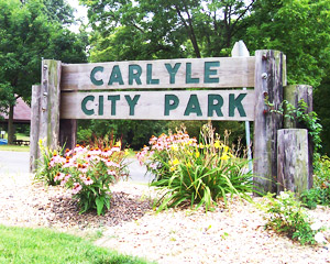


Carlyle Lake Hunting
A tremendous variety of outdoor recreational opportunities and natural beauty awaits you at Carlyle Lake State Fish & Wildlife Area, 60 miles east of St. Louis, near Vandalia. The area is at the northern end of Carlyle Lake and at the southwestern tip of Fayette County.
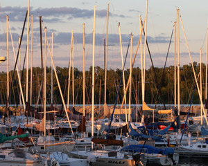
Carlyle Lake is a 26,000-acre multipurpose lake administered by the U.S. Army Corps of Engineers. The Department of Natural Resources has a 25-year lease on part of the Army Corps’ property to conduct a variety of habitat management measures aimed at increasing food, shelter and nesting areas for numerous wildlife species.
Recreational opportunities abound on the lake and at Eldon Hazlet State Park, at the southern end of the lake. At the Fish and Wildlife Area, however, the pleasures are simple and revolve mainly around enjoying the beauty and solitude of nature as visitors birdwatch, fish and hunt.
The federal lease land and state property provide almost 9,500 acres of wildlife habitat. The Fish and Wildlife Area is blessed with habitat diversity: approximately 2,000 acres of woodland, 5,800 acres of open water and wetlands, 200 acres of grassland and 1,500 acres of cropland planted for wildlife food and cover. The area is divided by the following management areas: Westside Management Area, Eastside Management Area, Flooded Dead Timber Area and Open Water Area.
Hunting and Fishing
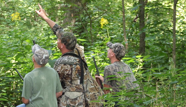
Carlyle Lake is known as one of the top waterfowl hunting areas in the state. The Department of Natural Resources also provides opportunities for hunting white-tailed deer, turkeys, squirrels, quail, rabbits and doves. Trapping is permitted after duck season and requires a permit from the site manager. Fishing is available on more than 2,000 acres of the lake and on the Kaskaskia River. Two boat ramps on the Kaskaskia River providing fishing access.
Bird watchers will enjoy observing bald eagles, ospreys, cormorants and great blue herons, as well as numerous species of shorebirds and songbirds.
Hunting & Fishing MapWestside Management Area
A network of levees separates the 3,500-acre bottomland area into several smaller and more manageable compartments. Habitat management consists of planting crops such as corn, milo, millet and winter wheat, and promoting the growth of natural wetland vegetation (moist soil management). Manipulation of water levels plays an important part in management of the area. By manipulating spring water levels, moist soil plants, such as wild millet, can grow in several permanent moist soil areas and in some fields planted to annual crops the previous year. In the fall, flooding the leveed areas provides migrating waterfowl access to the food. Access this area at Cox’s Bridge, Hitogi Access Area, or parking lots at Subimpoundments 1, 2 or 3.
Eastside Management Area
The 2,500-acre area located on the east side of the Kaskaskia River provides opportunities for waterfowl, upland and forest game hunters. The area is blessed with numerous natural wetlands and a large tract of timber. Additionally, several fields are planted to wildlife food plants. Fields also are planted to provide dove hunting opportunities. Access is by way of two parking lots at Eckert’s Woods, and the Hitogi and Cox’s Bridge access fields.
Flooded Dead Timber Area
Creek channels, islands and standing dead timber scattered throughout the water area provide numerous opportunities for hunting. Access to both the Flooded Dead Timber Area and Open Water Area is by way of Boulder, Cox’s Bridge, East Fork Creek, Keyesport, North Fork Creek, Patoka and Tamalco access areas.
Open Water Area
Open water south and north of the B&N Railroad provides opportunities for scenic boating, birdwatching and hunting. The area provides resting and roosting space, which encourages a greater waterfowl population. Access to both the Flooded Dead Timber Area and Open Water Area is by way of Boulder, Cox’s Bridge, East Fork Creek, Keyesport, North Fork Creek, Patoka and Tamalco access areas.


